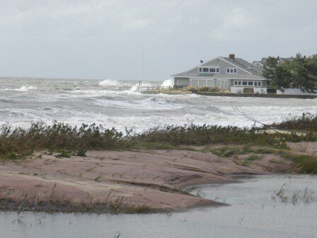
Climate Preparedness Workshops Provide a Head Start Toward Resilience
Stressors and impacts
After experiencing a tornado in June 2010, Tropical Storm Irene in August 2011, and the "Halloween nor’easter" of 2011, residents of Bridgeport, Connecticut, recognized that they could benefit by being better prepared for extreme events. City leaders sought information to begin developing a plan, and they learned that an inventory of their infrastructure and vulnerabilities could help them identify priorities for reducing potential risks. What they didn't know is that their resilience would be tested again very soon, when Hurricane Sandy arrived in October 2012.
A community studies its options
Drawing upon training materials and expertise from a range of national and local partners, a set of community leaders and decision makers from Bridgeport participated in climate preparedness workshops. The group used NOAA’s Roadmap for Adapting to Coastal Risk and The Nature Conservancy’s Coastal Resilience Decision Support Tool. Workshop participants engaged in conversations about actions the community could take to reduce risk and increase resilience; they also examined maps showing potential flooding from extreme events and sea level rise, and then worked together to identify the community's top hazards and priorities for action.
Ready or not, here comes Sandy
In October 2012, the community had barely begun their planning process when Hurricane Sandy struck, carrying an unprecedented 13-foot storm surge. The importance of the top three hazards identified during the climate preparedness workshops—coastal and inland flooding, storm surge from tropical storms and hurricanes, and rising seas and groundwater levels—were affirmed by Sandy’s impact. Despite Sandy’s punch, the community had a head start in its path to resilience.
Post-Sandy, Bridgeport's leaders resumed the planning process with renewed interest. The city began working to update its Natural Hazard Mitigation Plan and took steps to enroll in the Federal Emergency Management Agency’s Community Rating System. The city's enrollment in this program that encourages community-wide participation in hazard mitigation and risk reduction strategies can entitle private property owners to reduced premiums in National Flood Insurance Programs. The Community Rating System also encourages cities to adjust building codes and land use policy, incorporate nature-based solutions such as marsh advancement zones and green infrastructure for managing storm water in their planning processes, and include climate change as a factor in redevelopment and infrastructure plans.
Despite repeated blows from extreme weather and climate events, Bridgeport continues to seek opportunities to take the next step in building resilience.
Adapted from NOAA Digital Coast, "Enhancing Resilience to Coastal Hazards in Connecticut."
Todd R. Emmerson. CC-BY-SA-3.0, http://creativecommons.org/licenses/by-sa/3.0/legalcode, via Wikimedia Commons


