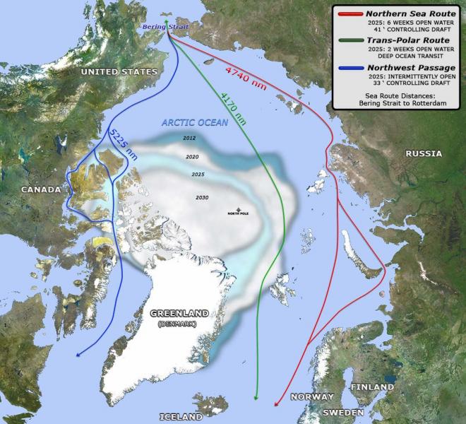
The U.S. Navy anticipates three major shipping routes across the Arctic region by 2025. Click the image for a larger view: the map's legend describes anticipated characteristics of each route.
Source:
Sea ice extents represent consensus estimates for minimum sea ice in the indicated years.
Page/s that contain this image:
Last modified:
3 January 2017 - 4:34pm

